Interactive Development Projects Map
Development Projects Map- General Planning Maps
- Approved Rezones 2002 - Present - North County
- Approved Rezones 2002 - Present - South County
- Approved Rezones 2002 - Present - East County
- Biodiversity Hotspots
- Community Development Districts (CDD)
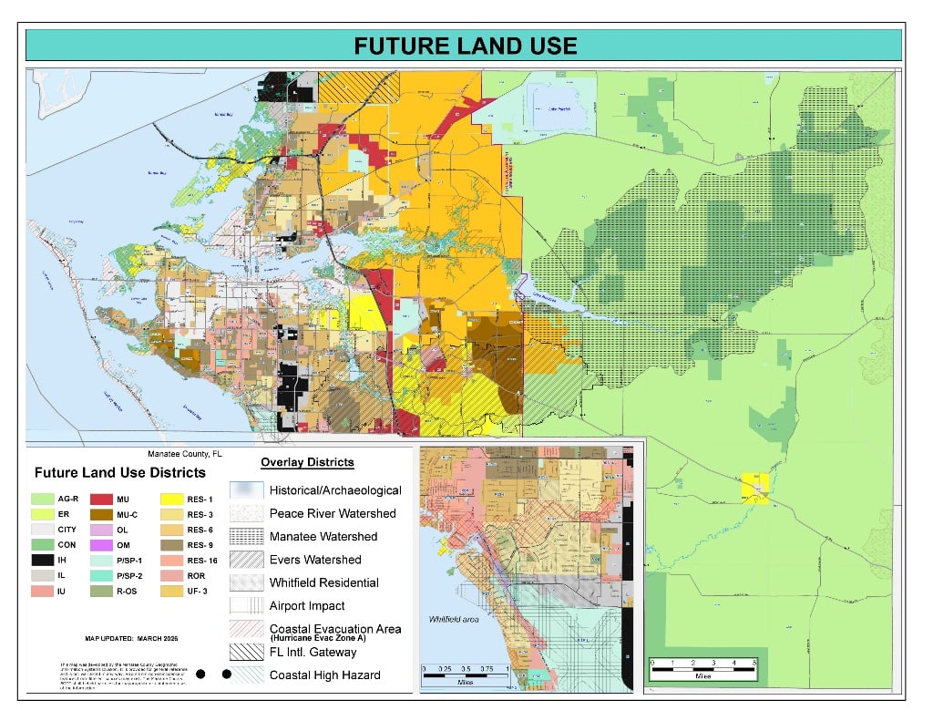
- Future Land Use Map Future Thoroughfare Map Series (Map 5A-F)
- Florida International Gateway (FIG) overlay
- Greenways Map from Adopted Greenways Master Plan 2002
- Port Manatee Encouragement Zone
- School Service Areas - SSA
- Southwest TIF
- Sub Areas (Planning)
- Transportation Concurrency Exception Areas (TCEA's)
- Urban Corridors
- Urban Service Area
- Zoning map (or look up zoning for a specific address - it will appear under "Property Information")
Zoning, Future Land Use and other layers are also in the interactive GIS web viewer.
City of Bradenton Maps
Entranceways
Zoning Overlay Districts
- Airport Impact Overlay District
- Evers Reservoir Watershed Protection Overlay District
- Lake Manatee Reservoir Watershed Protection Overlay District
- Peace River Watershed Protection Overlay District
- Historical and Archaeological Overlay District
- Manufacturing Development Plan Overlay
- Parrish Commercial Village Overlay
- Restricted Vehicle (RV) Overlay District
- Special Treatment (Stormwater) Overlay District
- Whitfield Residential Overlay District
FEMA flood maps are available in the Building Department on the 4th Floor of the Manatee County Administration Complex. For more information about the FEMA maps, please call the Building Department at (941) 746-3090.
Specific maps can be ordered through the Manatee County Property Appraiser's Office Mapping Section (941) 748-8208.